Wednesday, 6 March 2013

1987

February 16, 1987


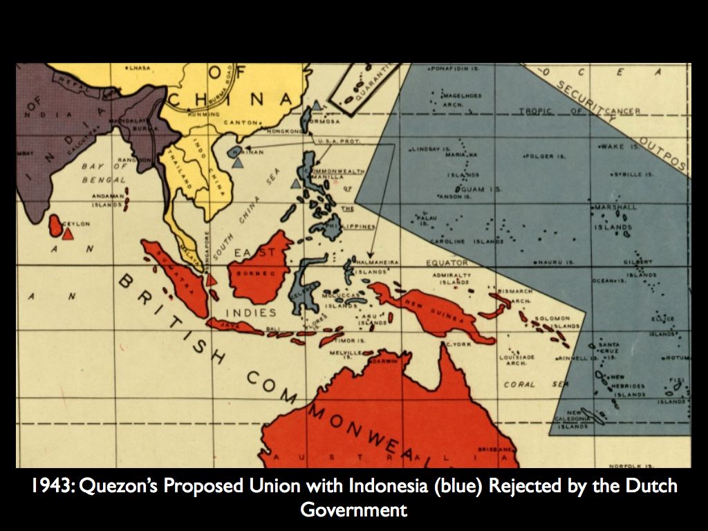
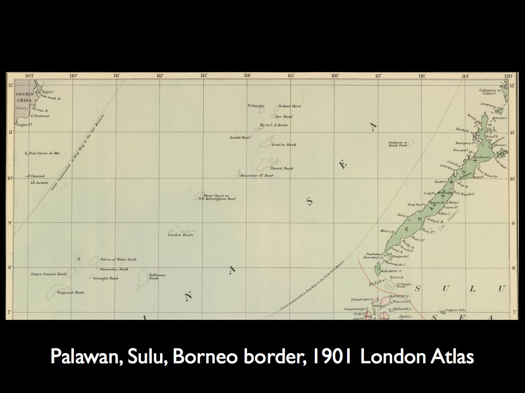
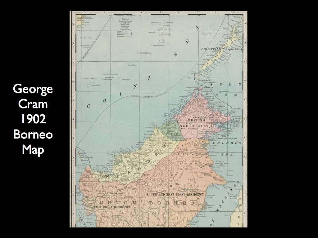
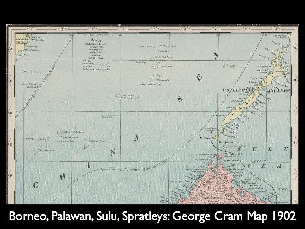
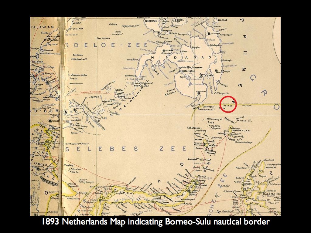
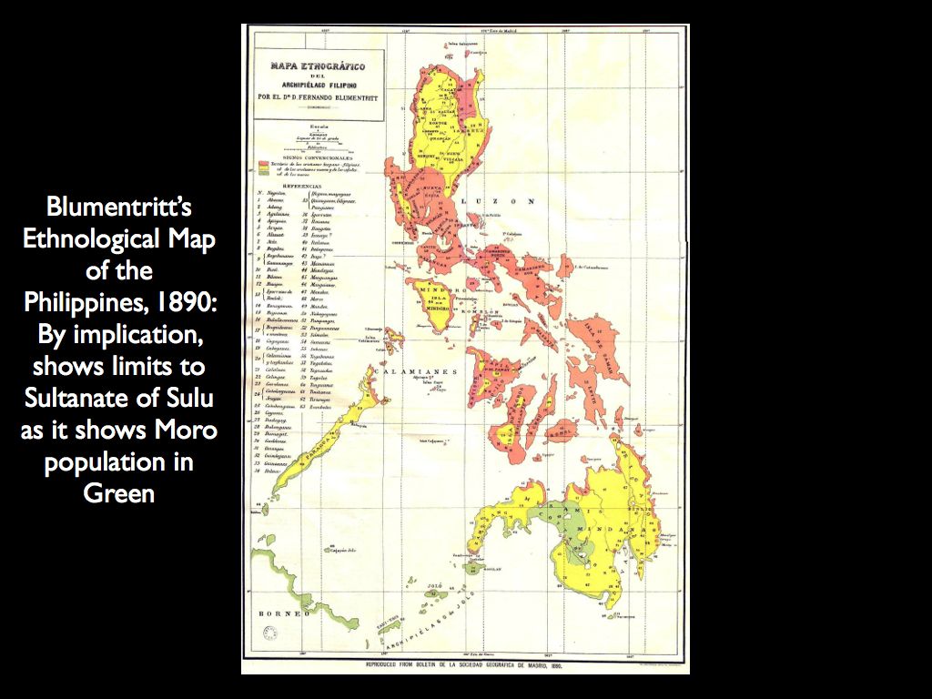
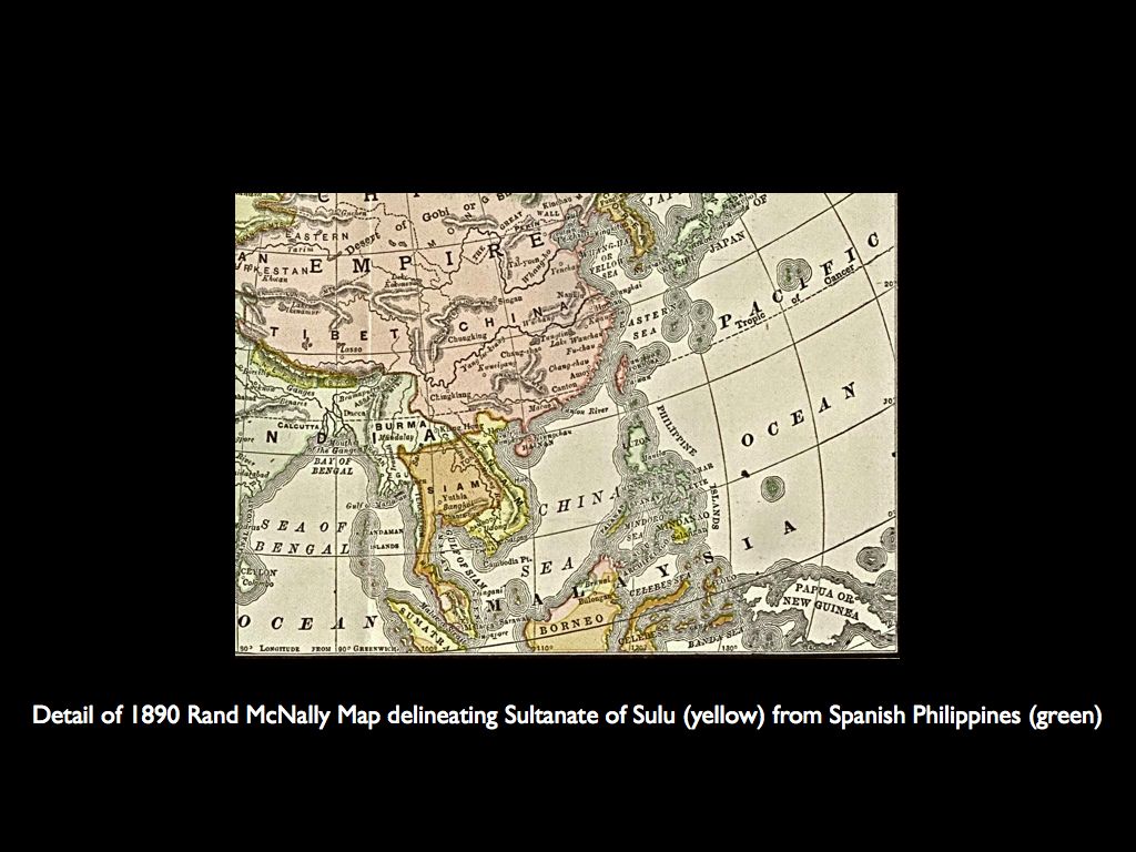
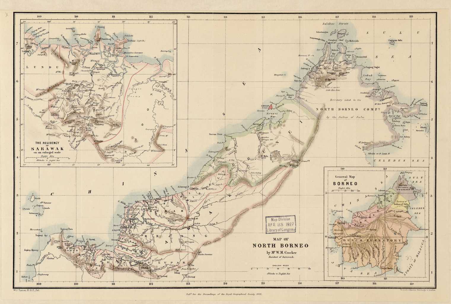
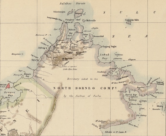
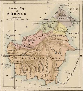
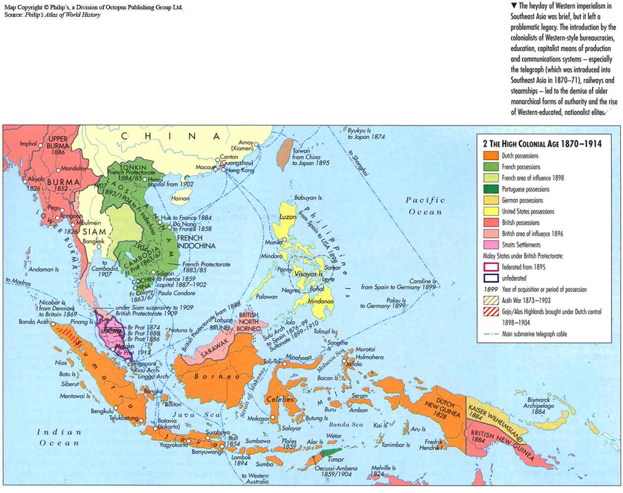
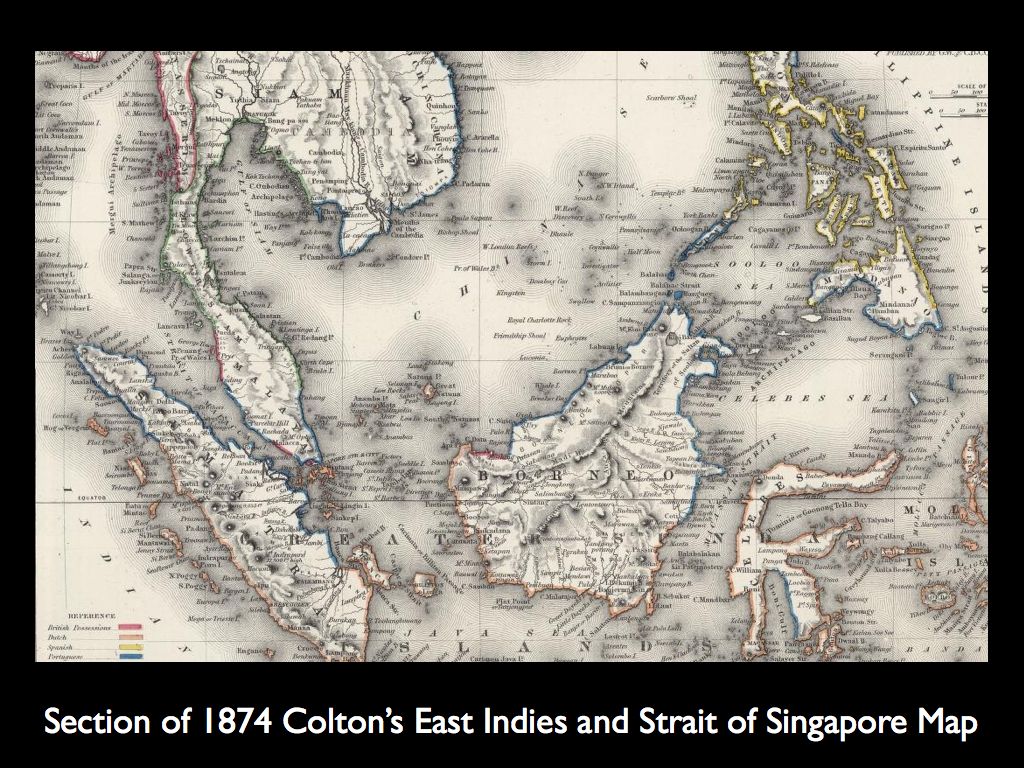
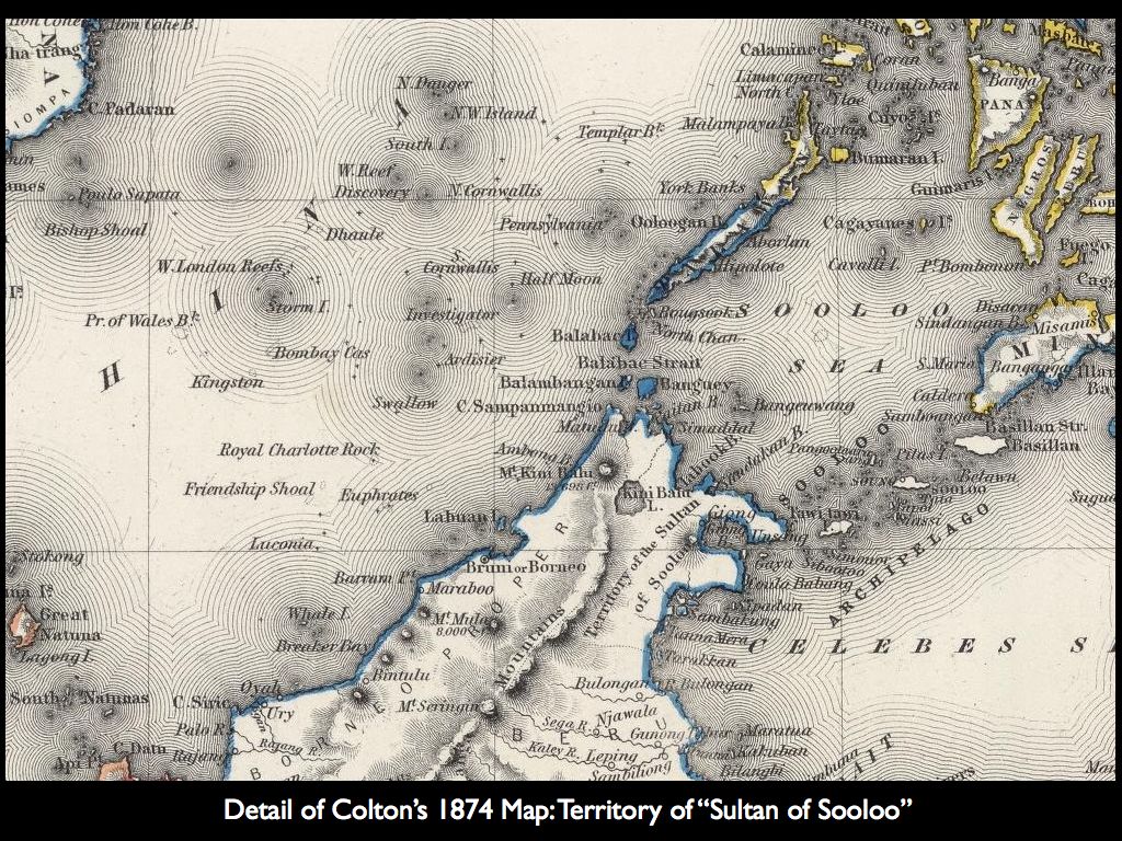
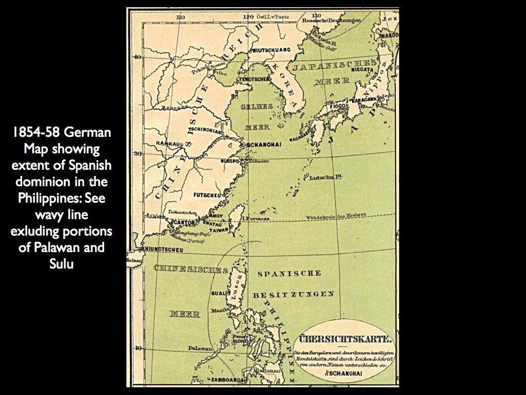
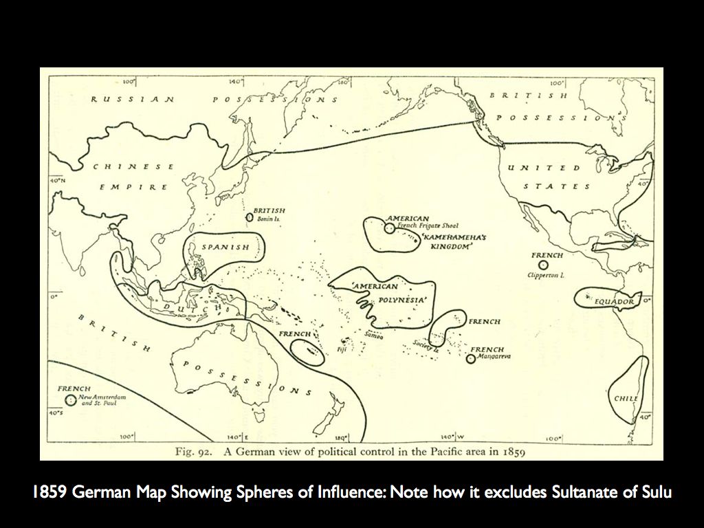
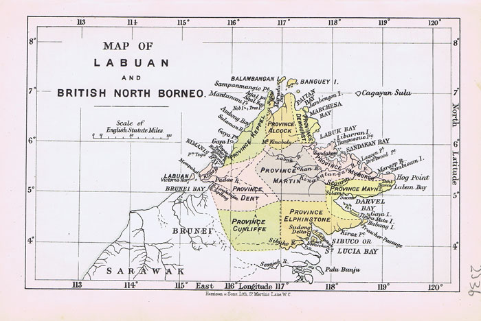
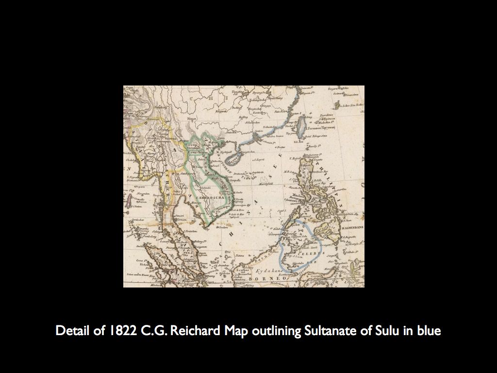
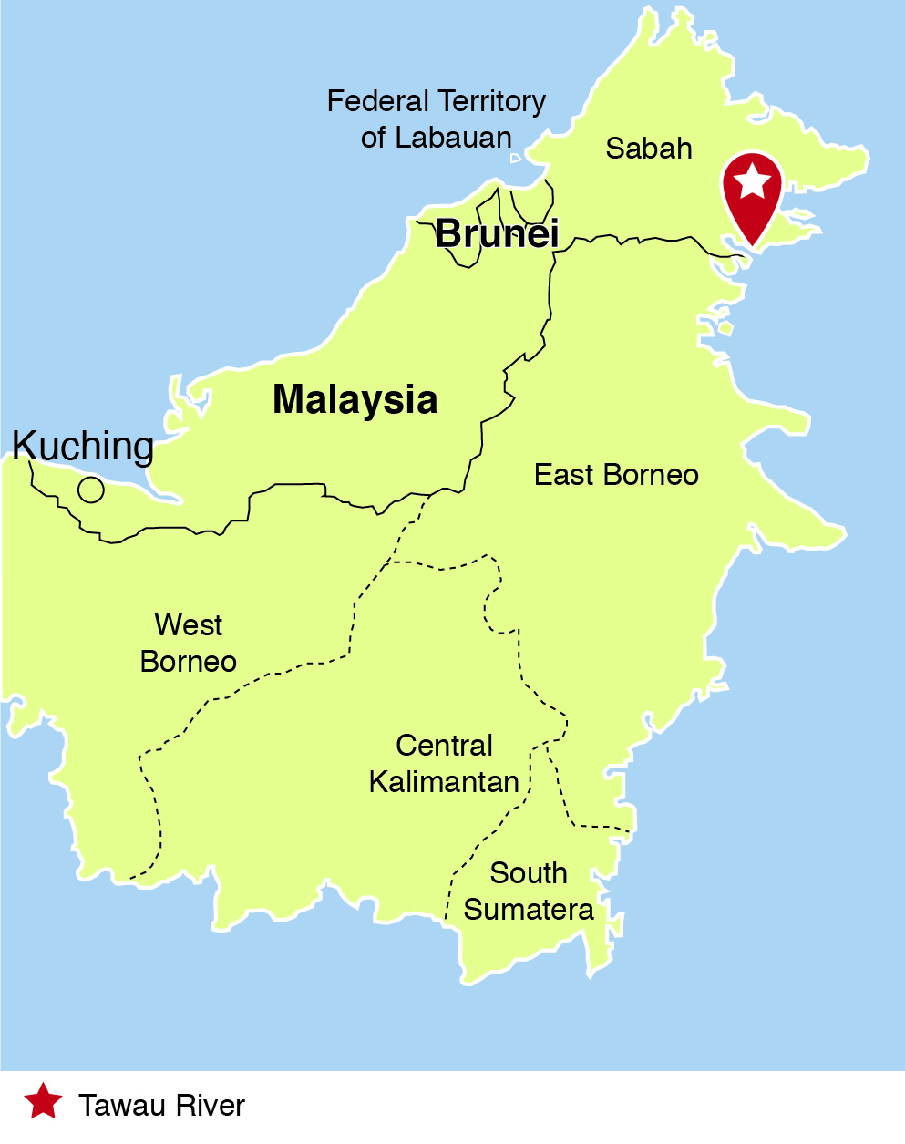
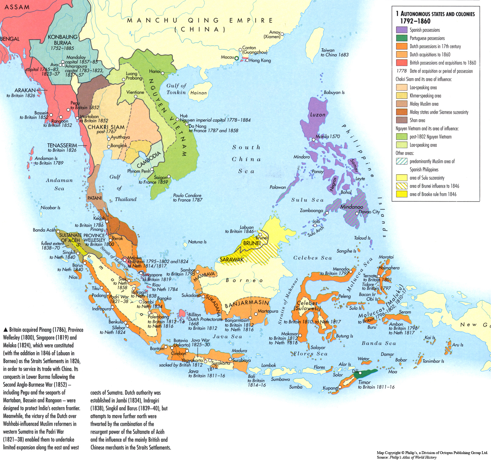
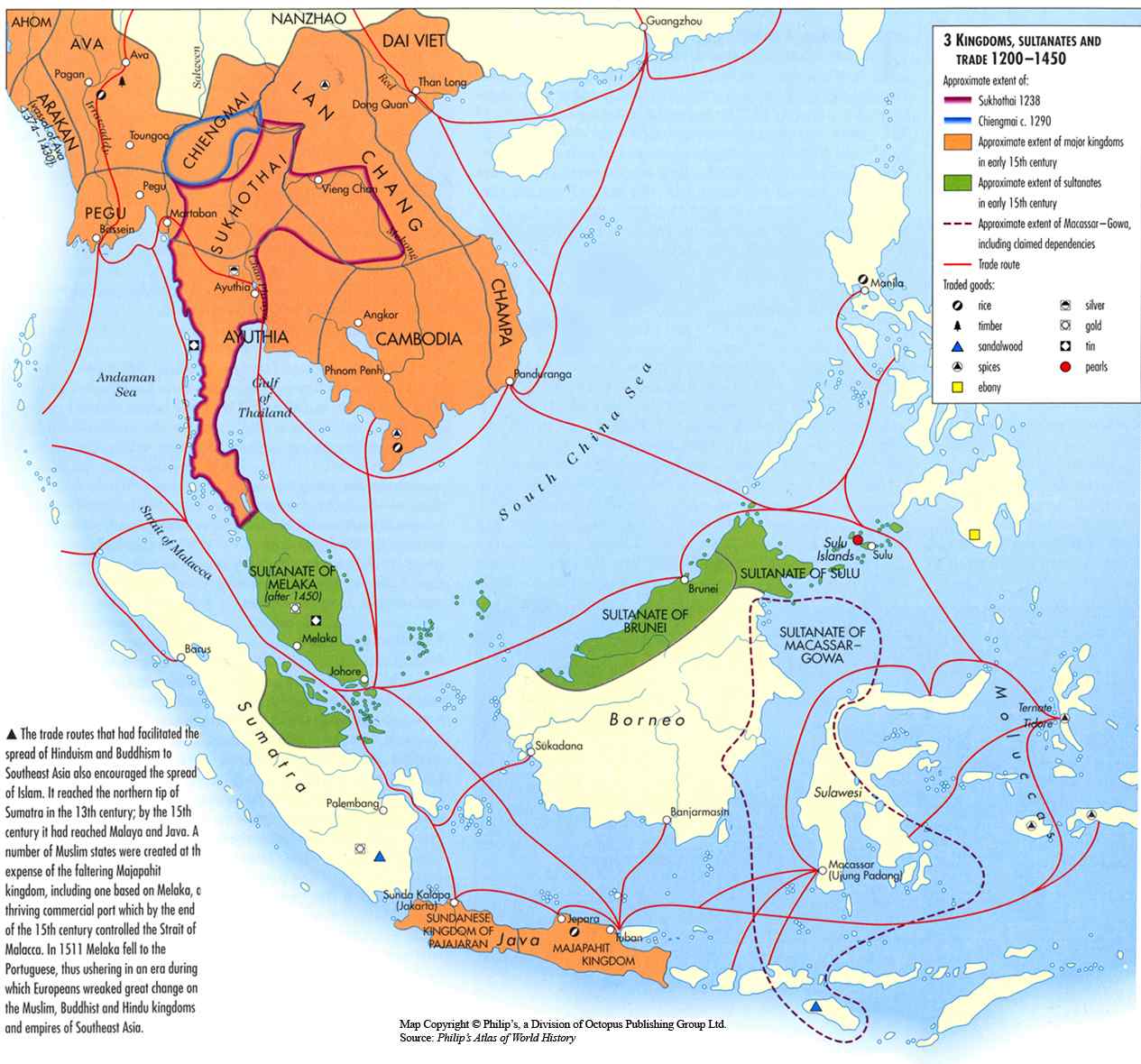
Philippines with various demarcations

1987 Constitution comes into full force and effect, in fulfilment of the first stipulation of the Malaysians.

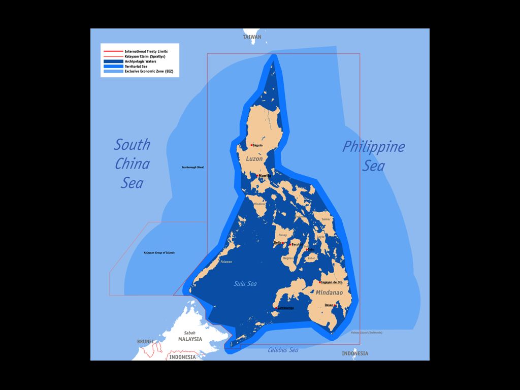
The national territory comprises the Philippine archipelago, with all the islands and waters embraced therein, and all other territories over which the Philippines has sovereignty or jurisdiction, consisting of its terrestrial, fluvial and aerial domains, including its territorial sea, the seabed, the subsoil, the insular shelves, and other submarine areas. The waters around, between, and connecting the islands of the archipelago, regardless of their breadth and dimensions, form part of the internal waters of the Philippines.

1942-1945


1942-1945

1901, 1902


(c) http://www.quezon.ph/2013/03/01/north-borneo-sabah-an-annotated-timeline-1640s-present/

1900, 1901


November 7, 1900
Consolidate the American possessions in the Sulu archipelago by including the islands of Sibutu and Cagayan, both of which had always formed part of the possessions of the Sulu sultanate.
British North Borneo Company obtains from Sultan of Sulu even more territory.


Philippines, Borneo: 1901 London Atlas


(c) http://www.quezon.ph/2013/03/01/north-borneo-sabah-an-annotated-timeline-1640s-present/

1898, Paris Treaty


December 10, 1898
Spain cedes the Philippine Islands to the United States of America. The treaty lines did not include North Borneo (Sabah).


Treaty of Paris


(c) http://www.quezon.ph/2013/03/01/north-borneo-sabah-an-annotated-timeline-1640s-present/

1894-1936, 1898


1894-1936
Sultan Jamalul Kiram II rules the Sultanate of Sulu.


(c) http://www.quezon.ph/2013/03/01/north-borneo-sabah-an-annotated-timeline-1640s-present/

1892, 1893


1892
Jose Rizal proposes to the Spanish government to establish a Filipino colony in Sabah. This plan, however, does not push through.

1890


(c) http://www.quezon.ph/2013/03/01/north-borneo-sabah-an-annotated-timeline-1640s-present/

1881


November 16, 1881
Spaniards protest granting of Royal Charter
By virtue of treaties of capitulation of 1836, 1851, and 1878, Spain exercised sovereignty over Sulu and its dependencies including North Borneo; Sultan of Sulu had no right to enter into any treaties or make any cessions whatsoever.


W.J. Turner 1881 Royal Geographical Society Map: Drawn by W.M. Crocker, representative of British North Borneo Company for 16 years. Compare to 1901 and 1902 maps to see ultimate adjustments of various borders. (map located by Roel Balingit)


W.J. Turner 1881 Royal Geographical Society Map, detail.


W.J. Turner 1881 Royal Geographical Society Map, inset map showing general divisions of North Borneo. Compare to 1901 Map to see further adjustments of borders.

(c) http://www.quezon.ph/2013/03/01/north-borneo-sabah-an-annotated-timeline-1640s-present/

1867


January 17, 1867
Earl of Derby to Lord Odo Russel:
“That, whatever Treaty rights Spain may have had to the sovereignty of Sulu and its dependencies, those rights must be considered as having lapsed owing to the complete failure of Spain to attain a de facto control over the territory claimed.”

The High Colonial Age 1870-1914


(c) http://www.quezon.ph/2013/03/01/north-borneo-sabah-an-annotated-timeline-1640s-present/

1851


April 30, 1851
Treaty signed with Spain by the Sultan of Sulu, Mohammed Pulalun. The Sultanate of Sulu was incorporated into the Spanish Monarchy.


1847


May 7, 1847
James Brooke is instructed by the British Government to conclude a treaty with the Sultan of Brunei
British occupation of Labuan is confirmed and Sultan concedes that no territorial cession of any portion of his country should ever be made to any foreign power without the sanction of Great Britain.
Labuan(c) http://www.quezon.ph/2013/03/01/north-borneo-sabah-an-annotated-timeline-1640s-present/

1824


March 17, 1824
Treaty of London signed by the Netherlands and Great Britain.
Allocates certain territories in the Malay archipelago to the United Kingdom and the Netherlands (Dutch East Indies).

1800–1850


1800–1850
This area (territory ceded to Sulu by Brunei) had been effectively controlled by the Sultanate of Bulungan in Kalimantan, reducing the boundary of Sulu to a cape named Batu Tinagat and Tawau River. (United Nations Publications)


Map showing Tawau river and Kalimantan.


(c) http://www.quezon.ph/2013/03/01/north-borneo-sabah-an-annotated-timeline-1640s-present/

1792-1860


1640's
Spain signed peace treaties with the strongest sultanates, Sulu and Maguindanao, recognizing their de facto independence.
1704
Sultan of Sulu became sovereign ruler of most of North Borneo by virtue of a cession from the Sultan of Brunei whom he had helped in suppressing a rebellion.
There is no document stating the grant of North Borneo from Sultan of Brunei to Sultan of Sulu, but it is accepted by all sides.


Autonomous States and Colonies 1792-1860


(c) http://www.quezon.ph/2013/03/01/north-borneo-sabah-an-annotated-timeline-1640s-present/

1200-1450


Kingdoms, Sultanates, and Trade 1200-1450


(c) http://www.quezon.ph/2013/03/01/north-borneo-sabah-an-annotated-timeline-1640s-present/