November 16, 1881
Spaniards protest granting of Royal Charter
By virtue of treaties of capitulation of 1836, 1851, and 1878, Spain exercised sovereignty over Sulu and its dependencies including North Borneo; Sultan of Sulu had no right to enter into any treaties or make any cessions whatsoever.
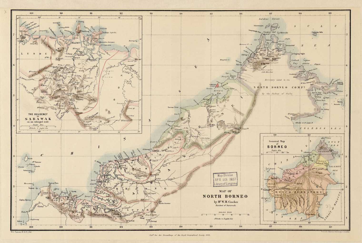
W.J. Turner 1881 Royal Geographical Society Map: Drawn by W.M. Crocker, representative of British North Borneo Company for 16 years. Compare to 1901 and 1902 maps to see ultimate adjustments of various borders. (map located by Roel Balingit)
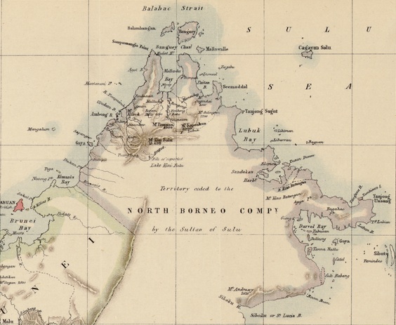
W.J. Turner 1881 Royal Geographical Society Map, detail.
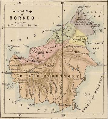
W.J. Turner 1881 Royal Geographical Society Map, inset map showing general divisions of North Borneo. Compare to 1901 Map to see further adjustments of borders.
(c) http://www.quezon.ph/2013/03/01/north-borneo-sabah-an-annotated-timeline-1640s-present/
W.J. Turner 1881 Royal Geographical Society Map: Drawn by W.M. Crocker, representative of British North Borneo Company for 16 years. Compare to 1901 and 1902 maps to see ultimate adjustments of various borders. (map located by Roel Balingit)
W.J. Turner 1881 Royal Geographical Society Map, detail.
W.J. Turner 1881 Royal Geographical Society Map, inset map showing general divisions of North Borneo. Compare to 1901 Map to see further adjustments of borders.
(c) http://www.quezon.ph/2013/03/01/north-borneo-sabah-an-annotated-timeline-1640s-present/
No comments:
Post a Comment